LABORATORY OF REMOTE SENSING
| Research > GPS > Santorini (1174x966 jpg, 76 Kb)
The
submarine crater of the Columbo volcano, just The
last significant volcano activity of Santorini was observed between
1925 and
1950, with four explosive periods. Santorini
GPS network was established in summer of 1994, consisting of twenty one
(21)
stations distributed in the island system of the area, to study the
ground
deformation associated with probable upward magma motions. The network
was
remeasured in 1995, 1996, 1998, 2005 and 2011. The results reveal
significant
ground deformation of both subsidence and uplift of the area.
Furthermore, a
correlation between the tectonic structure and the observed deformation
is
finally achieved. The system has
been in a quiet state the last 60 years, until January 2011 when the
volcano
reawakened, starting producing higher seismicity rates and showing a
radial
ground deformation. In the following, the ground deformation is
presented since
1992, based on the advanced SqueeSAR analysis, local DGPS network and
continuous recording GPS (CGPS) stations on the island. The spatial
deformation
of the System during the "quiet" period 1992-2010 deduced by joint
interpretation of ERS1&2 and ENVISAT images of ascending and
descending
geometry. This period, Palea Kammeni was getting uplifted (2-3 mm/yr),
characterized by an increasing rate of uplift, whilst the adjacent Nea
Kammeni
was subsided (up to -3 mm/yr) with increasing rates. The above two
islets even
though they are considered as a single volcanic center they exhibit a
different
type of vertical motion. The rest of the study area showed a velocity
field
varying from -1 to +2 mm/yr and sub-millimeter acceleration field
values,
indicating a linear deformation during this period. Combining ascending
and
descending radar data, the vertical and horizontal (E-W) component of
the
velocity field were determined. Several deformation patterns were
identified: The
two main tectonic features, the Columbo and the Kammeni lines at the
northern
and central part of the system, the Alpine basement at the SE part of
Thera,
and a pattern associated with the graben basin at the southern part,
consistent
to earlier AMT work and the recently compiled Gravity Anomaly Map. The
remeasurement periods of the GPS network (established in 1994) resulted
in the
calculation of the strain field, and velocity deformation patterns
consistent
to the SqueeSAR analysis results. The deformation study for the
“active” period
2011-2012 was based: (i) on the SqueeSAR analysis of ENVISAT images of
≈39 deg
LOS angle, and (ii) the processing of CGPS and DGPS data. Mogi
point-source
modelling suggests an expanding (magmatic) sphere (radius ≈150m)
located ≈1.5km
north of Kammeni at a depth of 3.7(±0.3) km, matching the
observed displacement
vectors. However, the seismicity seems to have lately drastically
decreased,
and a velocity decrease at some CGPS station components is also
noticed. If
that situation continues, the volcano may not reach any further state
of alert
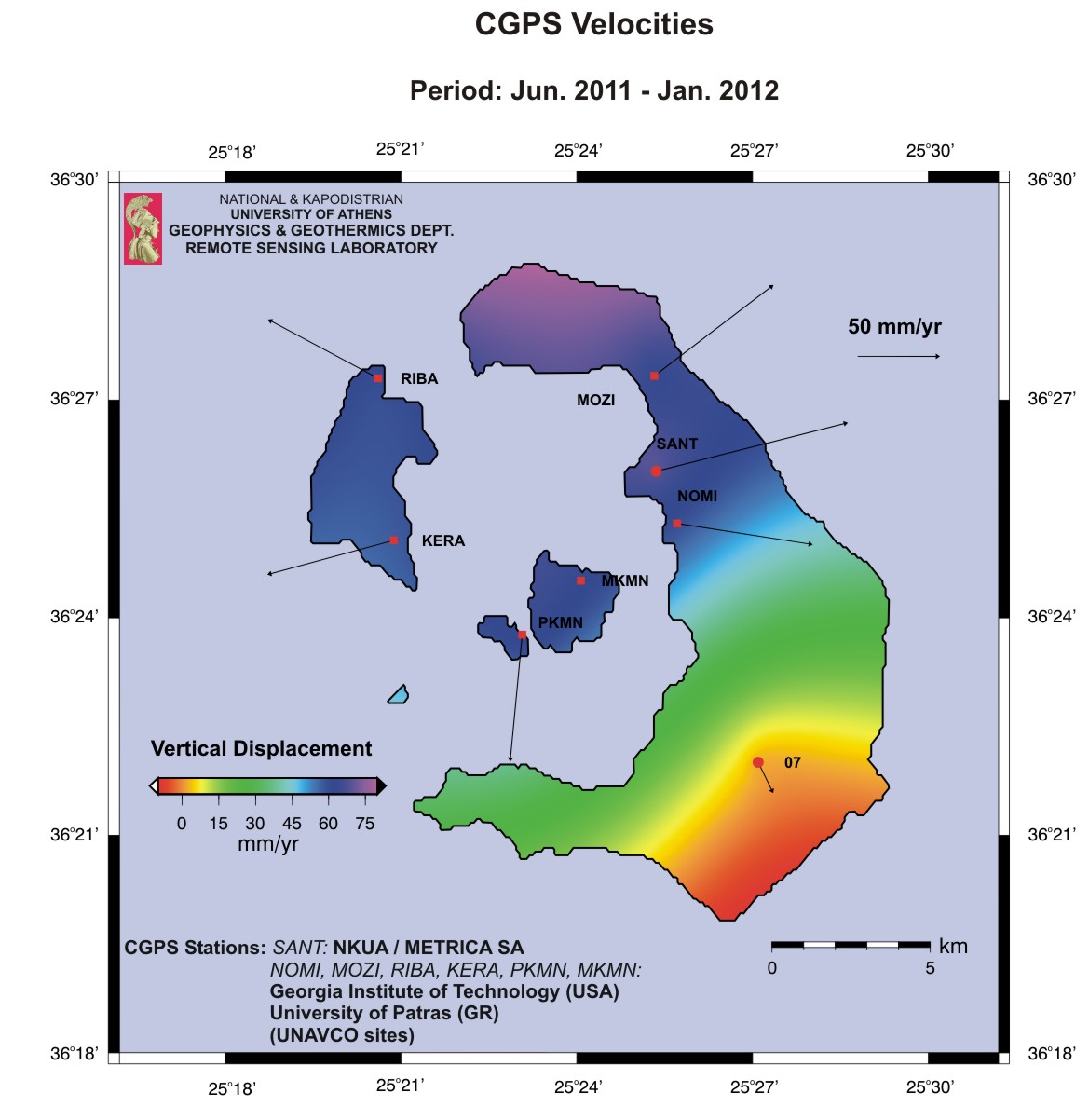
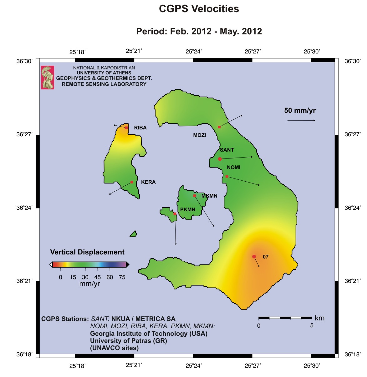
in the near future. In July 2011 a Continous GPS station was
establised in Imeroivgli to better monitor the ground deformation,
together with six (6) CGPS sites of the
UNAVCO operated by Georgia Institute of Technology and
University of Patras.
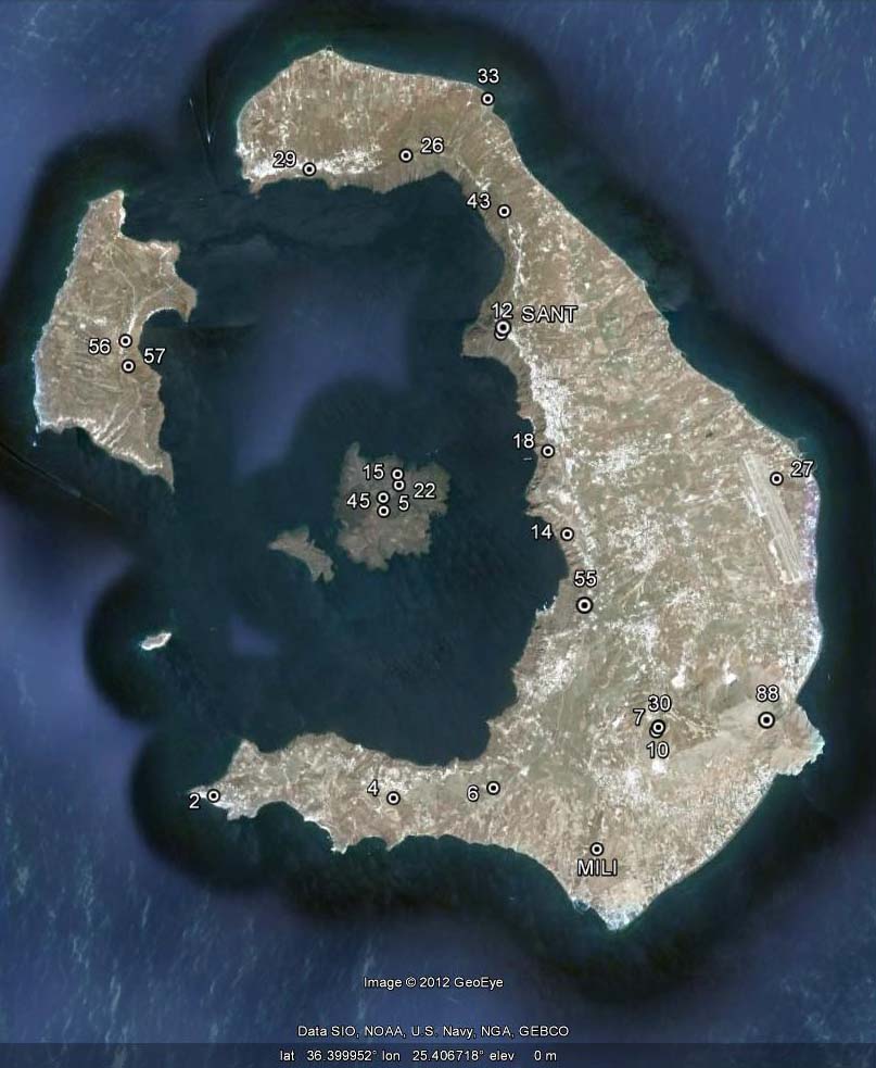
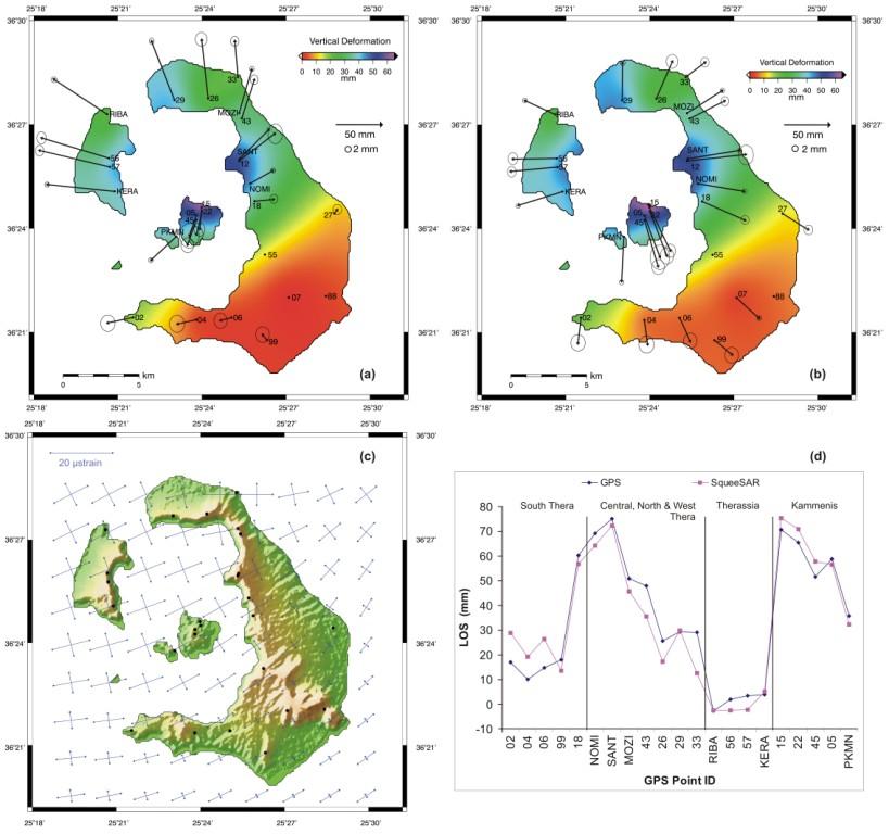
Local
GPS
Network of Santorini
GPS
ground
displacement maps (mm) for the period Sept. 2011 to June 2012, referred
to (a) No. 07 local reference station; (b)
ITRF2008; (c) Strain field (μstrain)
deduced from the DGPS measurements; (d) Diagram
showing comparison between GPS vectors projected on the
LOS direction and the corresponding PS/DS vectors (rms=7.3 mm)
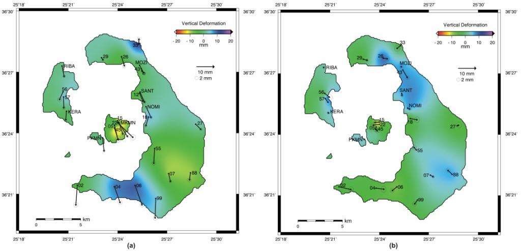
(a) GPS
ground deformation map
for the period June to Sept. 2012 (ITRF2008); (b) GPS
ground deformation map for the period Sept. to Dec. 2012
(ITRF2008).
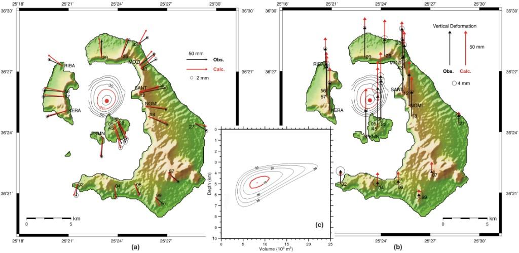 Mogi modelling of the
observed (black arrows) and calculated (red arrows) of the GPS
displacements for the period Sept. 2011 to June 2012 for (a) Horizontal and (b) Vertical components. Red dot
indicates the location of the best-fit Mogi source. (c) Diagram between depth and volume
variation for the best fit location. Normalized χ2 error contours are
also shown; red contour line indicates the 90% confidence level for the
location estimate, and 95% confidence level for the Volume vs Depth
estimates.
  REFERENCES:
|
| [GPS|DINSAR|Thermal Imaging|Optical
Images|GIS|Digital
Cartography] [Personnel|Recent publications|Projects|Links] [webmaster@space-unit.gr] |