LABORATORY OF REMOTE SENSING
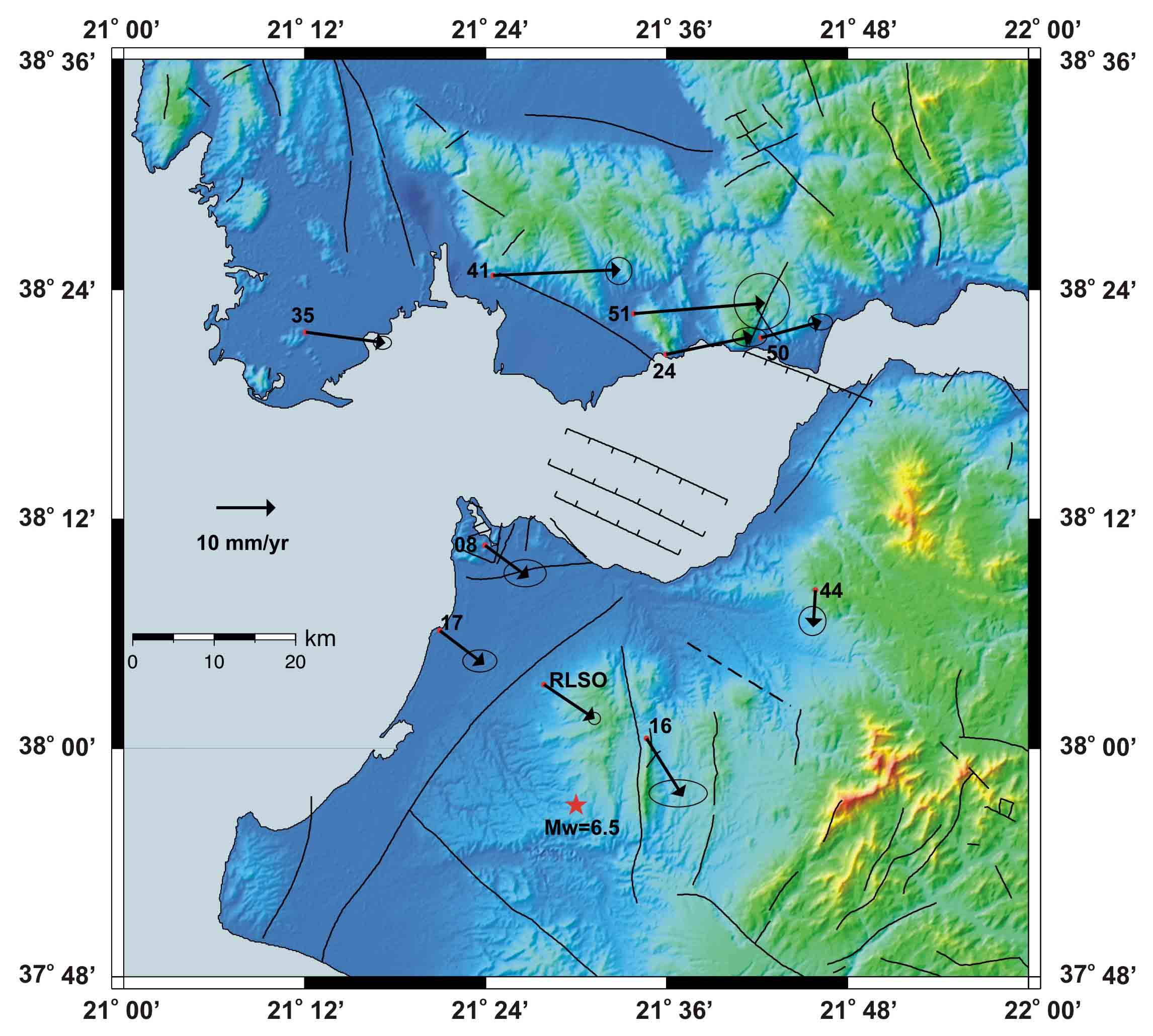
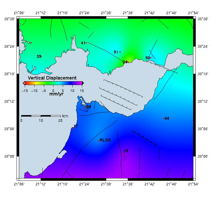
| Research > GPS > Patras Gulf (1490x1031 jpg, 90 Kb) The Patras Gulf located in the Western part of Greece is an area of very high seismic activity; a event in the region was the Egion (M=6.2) earthquake of June 1995 and the Andravida Earthquake (Mw=6.4) in 2008. A GPS network of ten (10) stations was established in 1994 and remeasured up to 2011. Significant micromovements were detected, confirming the anticipated tectonc movements of the area.
Horizonral & Vertical Velocity maps of the
Patras Gulf for the period 1994-2006 (ITRF 2000)
|
| [GPS|DINSAR|Thermal Imaging|Optical
Images|GIS|Digital
Cartography] [Personnel|Recent publications|Projects|Links] [webmaster@space-unit.gr] |