LABORATORY OF REMOTE SENSING
|
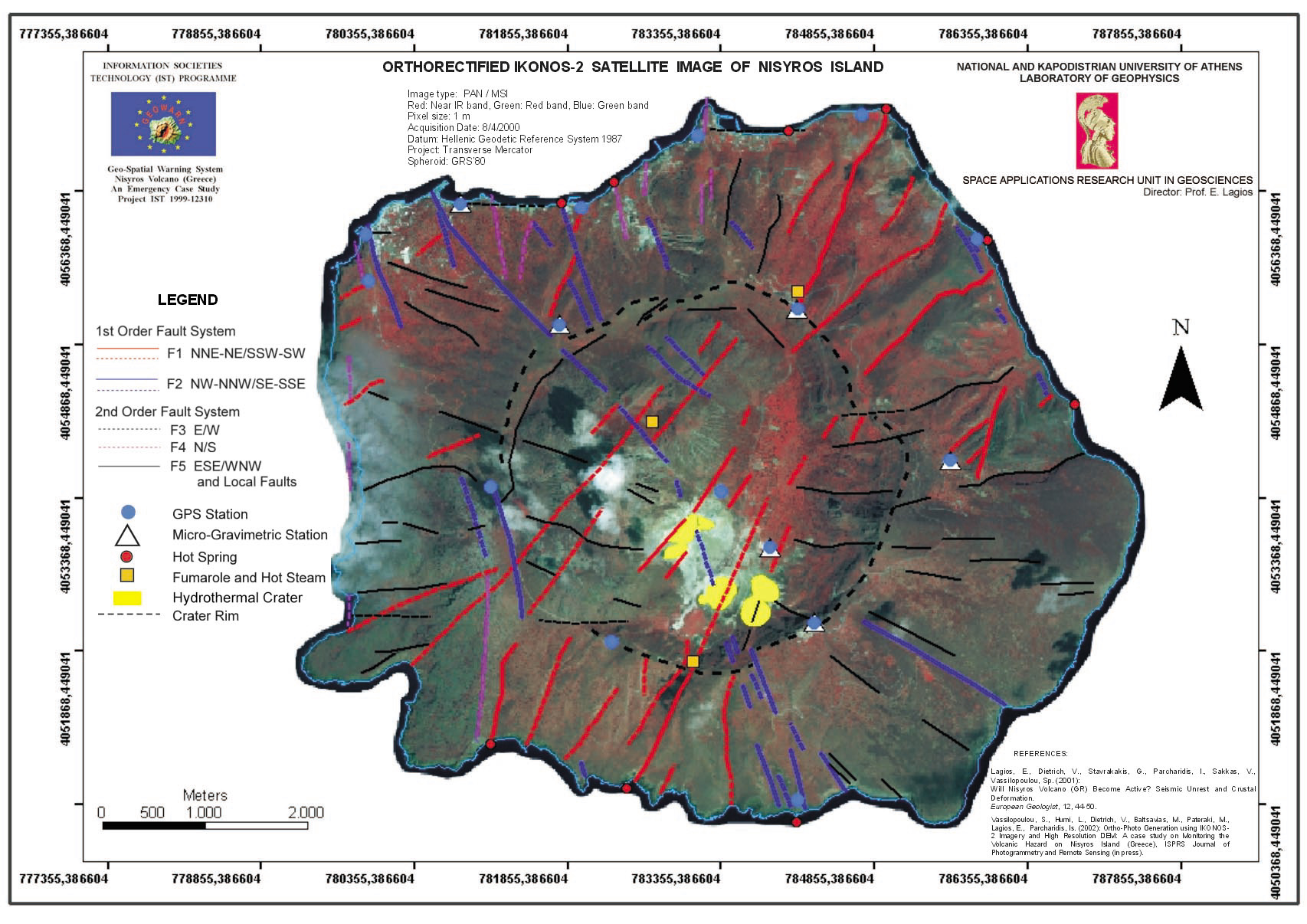
Research > Digital cartography > Tectonic Ortho-photo map of Nisyros island (Greece) based on the ortho-rectified IKONOS-2 satellite image. (1706x1206 jpg, 504 Kb)
|
|
[GPS|DINSAR|Thermal Imaging|Optical
Images|GIS|Digital
Cartography]
[Personnel|Recent publications|Projects|Links] [webmaster@space-unit.gr] |