LABORATORY OF REMOTE SENSING
|
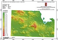
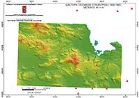
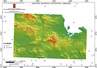
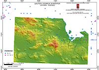
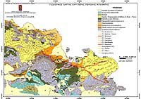
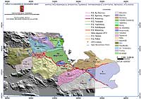
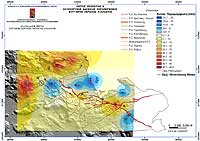
Research > GIS > ATALANTI FAULTING ZONE The Atalanti Faulting Zone is one of the main tectonic active systems of Central Greece. A large number of various data (topographic, geological, tectonic, morphotectonic, seismological, geodetic, satellite images) from different sources, in different format, scale and map projections has been compiled within the framework of the Research Project "Multi-disciplinary studies in the Broader Area of Atalanti Fault (Greece)". Layers in vector and raster format as well as thematic and synthetic maps (Maps 1-7) were produced in a common cartographic system (Hellenic Geodetic System 1987) and a GIS database was developed aiming to Earthquake Emergency Planning.
|
|
[GPS|DINSAR|Thermal Imaging|Optical
Images|GIS|Digital
Cartography]
[Personnel|Recent publications|Projects|Links] [webmaster@space-unit.gr] |