LABORATORY OF REMOTE SENSING
|
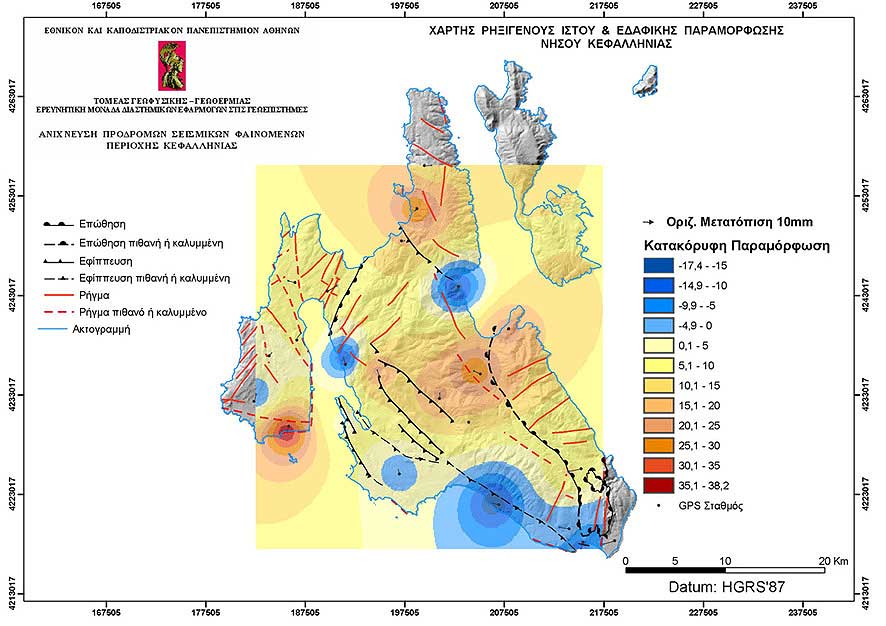
Research > GIS > Earthquake Emergency Planning (Cephallonia) > Map of horizontal and vertical ground deformation of Cephallonia Island for the period 2001 – 2003 (886x626 jpg, 81 Kb)
|
|
[GPS|DINSAR|Thermal Imaging|Optical
Images|GIS|Digital
Cartography]
[Personnel|Recent publications|Projects|Links] [webmaster@space-unit.gr] |