LABORATORY OF REMOTE SENSING
|
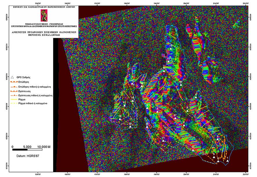
Research > GIS > Earthquake Emergency Planning (Cephallonia) > 3D Model of DinSAR of Cephallonia Island (Sept. 1995 – Aug. 1998) overlaid by tectonic data (886x609 jpg, 155 Kb)
|
|
[GPS|DINSAR|Thermal Imaging|Optical
Images|GIS|Digital
Cartography]
[Personnel|Recent publications|Projects|Links] [webmaster@space-unit.gr] |