LABORATORY OF REMOTE SENSING
|
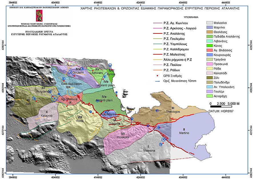
Research > GIS > Earthquake Emergency Planning (Atalanti) > Horizontal ground deformation of Atalanti area superimposed to the tectonic map (showing Fault & tectonic blocks) (886x626 jpg, 102 Kb)
|
|
[GPS|DINSAR|Thermal Imaging|Optical
Images|GIS|Digital
Cartography]
[Personnel|Recent publications|Projects|Links] [webmaster@space-unit.gr] |