LABORATORY OF REMOTE SENSING
|
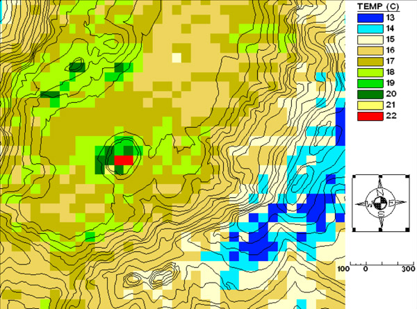
Research > Thermal imaging > LANDSAT 7 Surface Temperature Map of the Stephanos Crater area (October 20, 2002) Black lines are elevation contours at 20-m intervals. Note the thermal anomaly indicated by red pixels inside the Stefanos Crater.
|
|
[GPS|DINSAR|Thermal Imaging|Optical
Images|GIS|Digital
Cartography]
[Personnel|Recent publications|Projects|Links] [webmaster@space-unit.gr] |