LABORATORY OF REMOTE SENSING
|
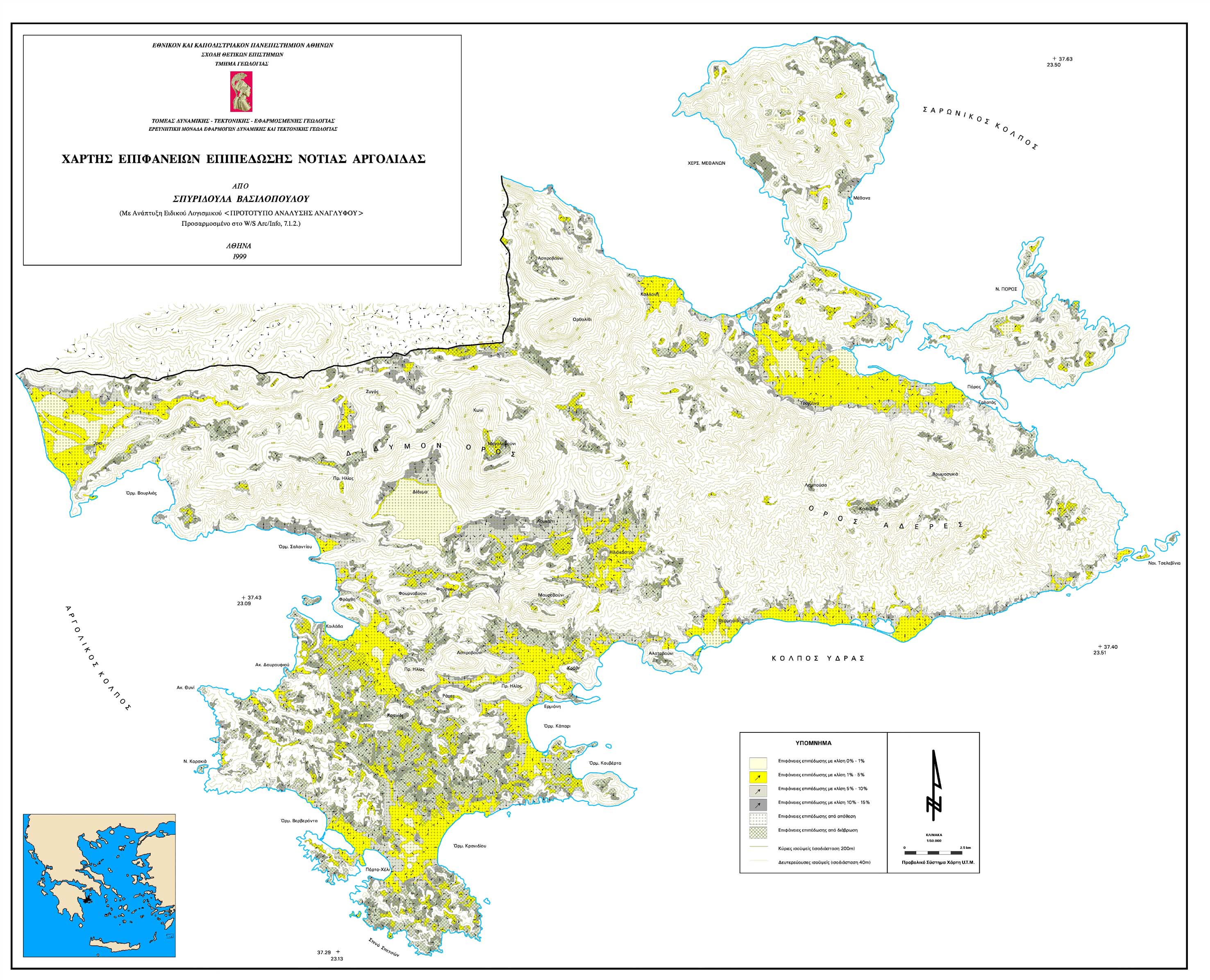
Research > GIS > Decision making > Planation Surfaces of Northern Argolis Peninsula by the Specific Software PROANA (2953x2391 jpg, 763 Kb)
|
|
[GPS|DINSAR|Thermal Imaging|Optical
Images|GIS|Digital
Cartography]
[Personnel|Recent publications|Projects|Links] [webmaster@space-unit.gr] |