LABORATORY OF REMOTE SENSING
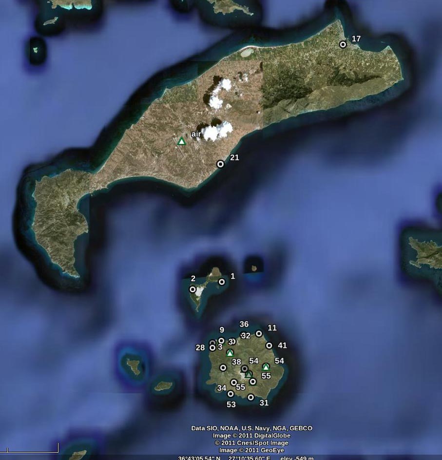
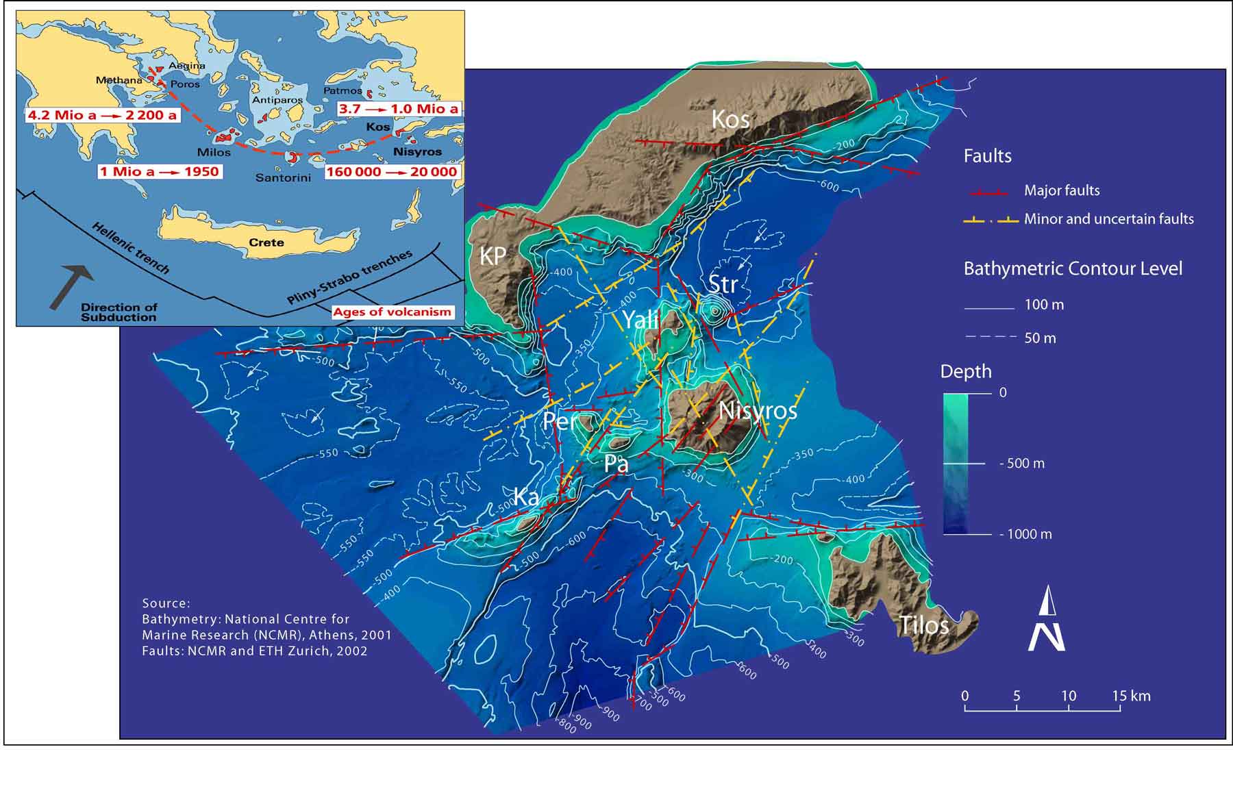
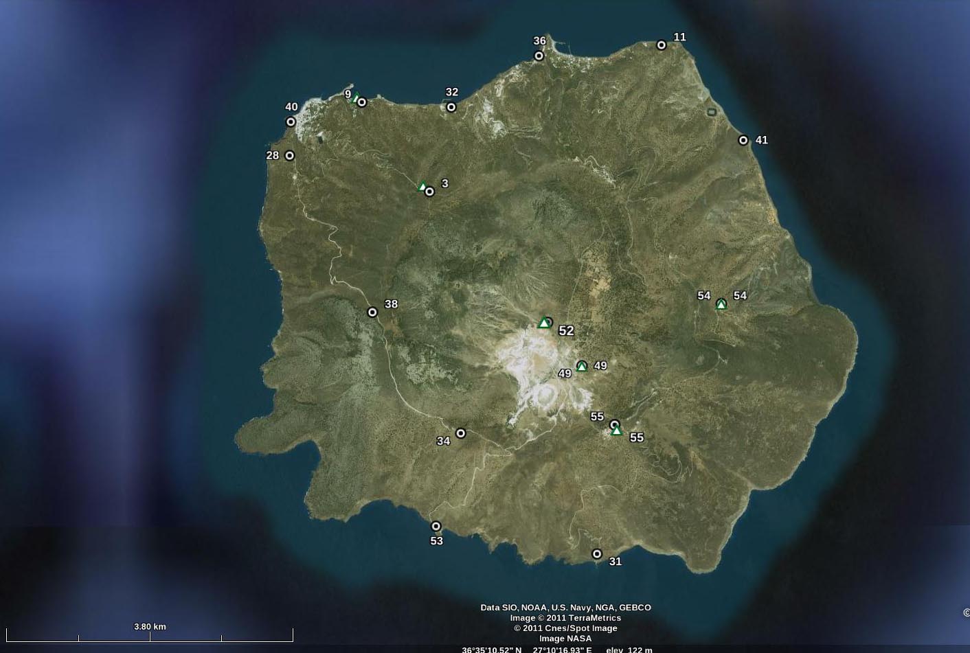
| Research > GPS > Kos – Yiali - Nisyros The Volcanic Field of Kos-Yiali-Nisyros islands is located to the SE part of the Hellenic Volcanic Arc. Together with the Santorini System, they constitute the two most major volcanic systems in the Aegean Sea. During the years 1996-1997 there was an earthquake crisis causing serious damages in Nisyros Island. A GPS network was established in June of 1997 consisting of nineteen (19) stations to study the ground deformation associated with probable upward magma motions. Since 1997 the GPS network was remeasured several times:
Significant
ground deformation has been observed in Nisyros Island due to the magma
influx at a magma chamber, at a depth of about 7 km, during the seismic
crisis of 1996-1997, initiated by the previous occurrence of deep
earthquakes in the broader area (Lagios et al. 2005).
GPS
network in Kos - Nisyros Islands
Triangles:
Micro Gravimetric
stations
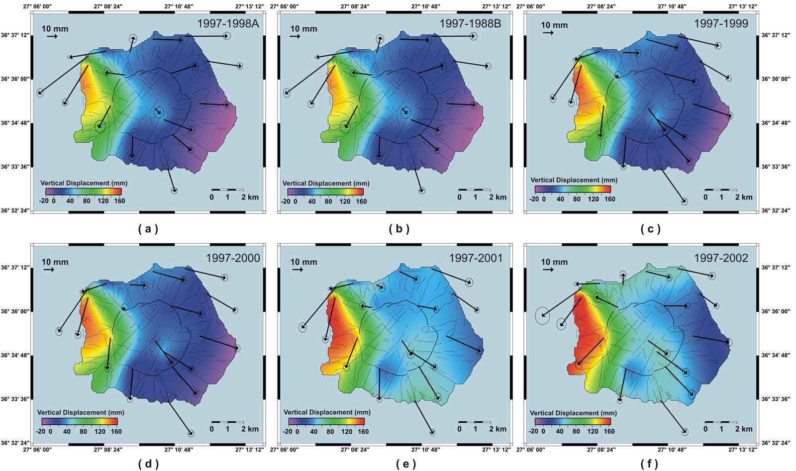
GPS Observations
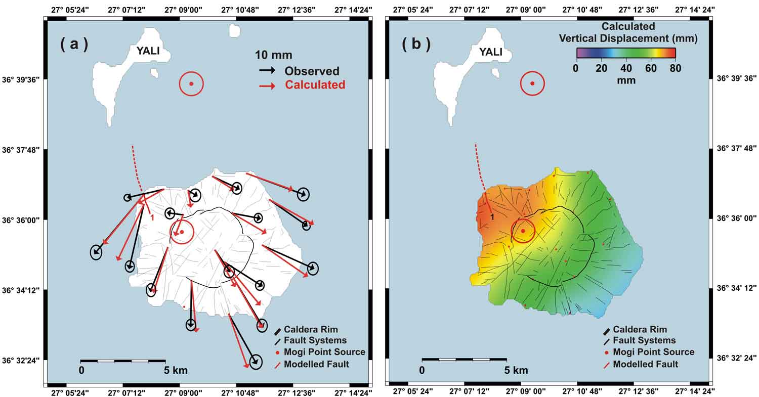
Observed (black arrows) and calculated (red arrows) horizontal deformation vectors for the period 1997-2001 using the Mogi Source Model at a depth of 7.5 km with 65 m expanding source parameter. Additionally to the Mogi Model the faults (marked with Red) in the NW and NE part of the island have been modelled using the RNGCHN programme (Feigl and Dupre 1999;Computers and Geosciences, 25 (6) pp. 695-704 ):
The
researc project was funded by the European Union, PROJECT IST
1999-12310 (www.geowarn.org)
References
|
| [GPS|DINSAR|Thermal Imaging|Optical
Images|GIS|Digital
Cartography] [Personnel|Recent publications|Projects|Links] [webmaster@space-unit.gr] |