LABORATORY OF REMOTE SENSING
|
Research > GIS > Decision Making System However,
a stand-alone GIS package is not by itself capable neither of solving
problems, nor of providing the correct answer to specific questions.
REFERENCES:
Vassilopoulou,
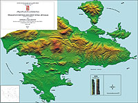
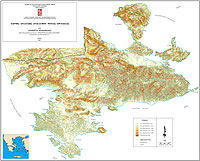
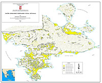
S. (2001): "PROANA" A Useful Tool for Terrain Analysis and
Geo-Environmental Applications – An Example of Studying the Geodynamic
Evolution of Argolis Peninsula, Greece. Proc. 20th International
Cartographic Conference, August 6-10, Beijing, China.
|
|
[GPS|DINSAR|Thermal Imaging|Optical
Images|GIS|Digital
Cartography]
[Personnel|Recent publications|Projects|Links] [webmaster@space-unit.gr] |