LABORATORY OF REMOTE SENSING
|
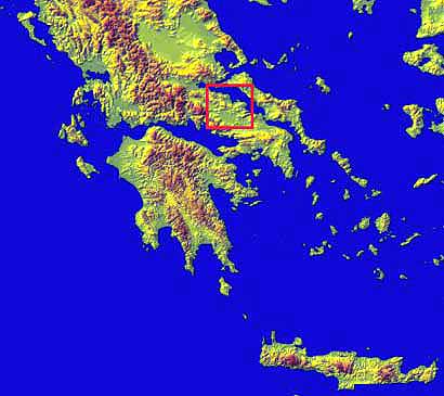
Research > DiNSAR > Atalanti Faulting Zone
To study the ground deformation in the area of Atalanti Faulting Zone three Radar Images have been used to create three Differential Interferograms. The three pairs that have been formed from the Radar Images are:
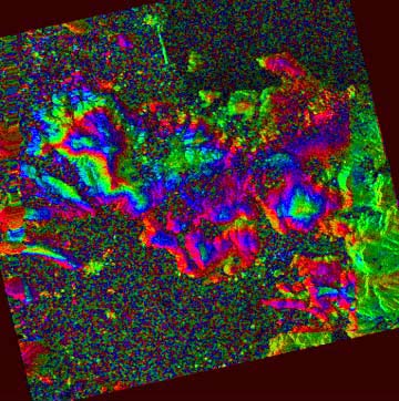
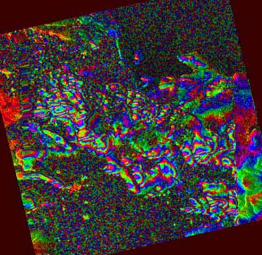
The interferometric images that have been produced are exposing strong topographic fringes without being able to show any fringes due to ground deformation. This phenomenon of topographic shaped fringes was caused probably by the atmospheric conditions that occurred in the area during the Radar images acquisition. Figure 1: Differential Interferogram for the period January 1999-October 1999
Figure 2: Differential Interferogram for the period June 1998-January 1999
Figure 3: Differential Interferogram for the period June 1998-October 1999
|

|
[GPS|DINSAR|Thermal Imaging|Optical
Images|GIS|Digital
Cartography]
[Personnel|Recent publications|Projects|Links] [webmaster@space-unit.gr] |