LABORATORY OF REMOTE SENSING
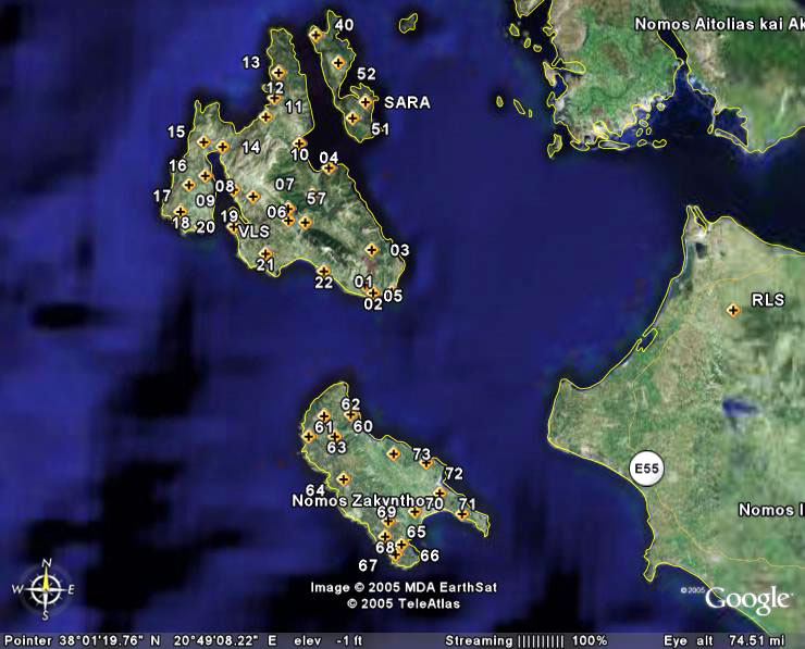
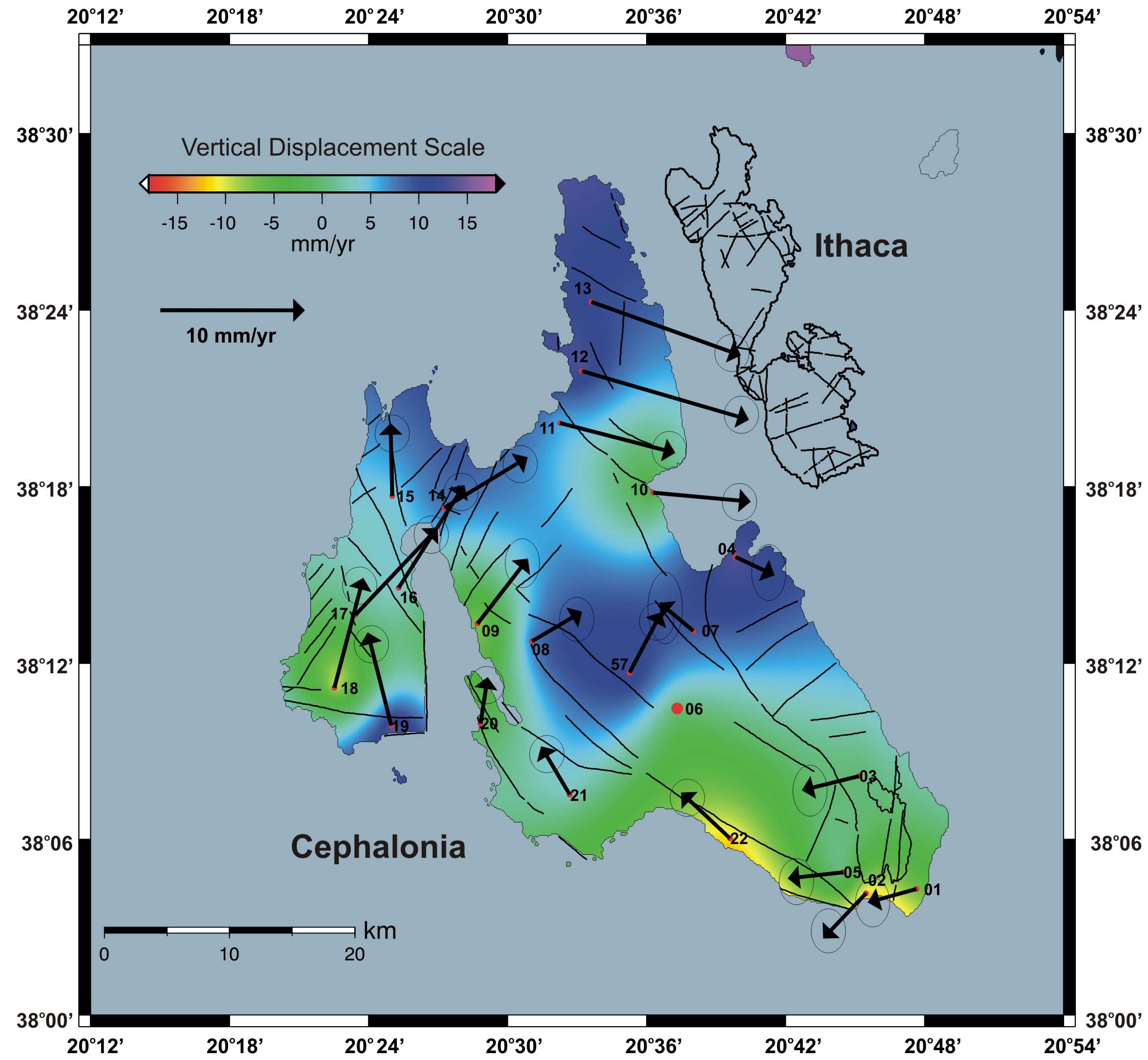
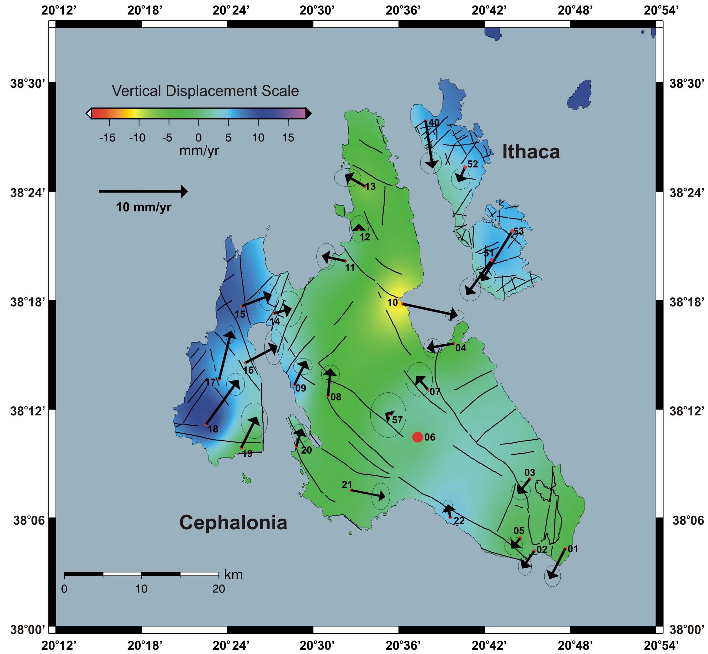
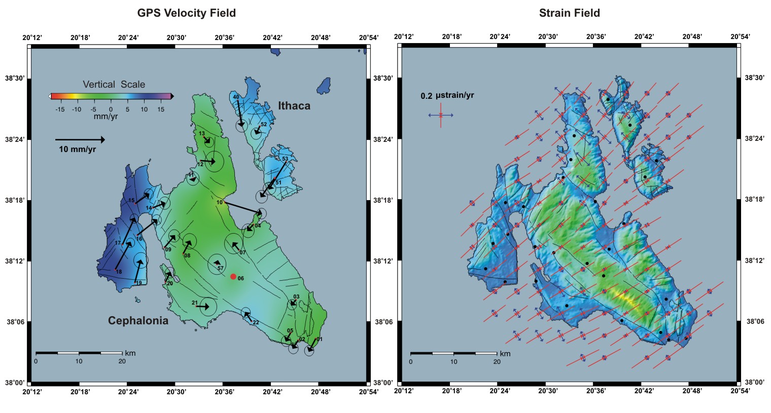
| Research > GPS > Ionian islands The Island of Cephallonia in the Ionian Sea is the most seismic active area in Greece. A large number of large magnitude earthquakes (M>6) have been observed in the region. The last major earthquake (M=6.7) took place in 1983. Since then no other significant earthquakes (M>6) took place. Ground deformation studies together with Radon and Acoustic Emission (AE) continuous recordings have been carried out in the seismically very active area of Zakynthos-Cephallonia-Ithaca, at an effort to detect precursory phenomena associated with large magnitude earthquakes. GPS local networks were first (2001) installed in Cephallonia, later (2004) in Ithaca, and finally (2005) in Zakynthos. The Cephallonia network has been remeasured six times since 2001. The network was referred to Dionysos (Athens) permanent GPS station, run by Prof. D. Paradeisis - NTUA Higher Geodesy Laboratory, to measure the regional deformation of the island. The GPS station No 06 in Cephallonia Island located to the Ainos Mt. was used as a reference station with fixed co-ordinates to study the local deformation. Additionally, a station located to the SW part of Peloponnesus was established and has been used as Reference station of the GPS network. CephalloniaThe Island of Cephallonia in the Ionian Sea is the most seismic active area in Greece. A large number of large magnitude earthquakes (M>6) have been observed in the region. The last major earthquake (M=6.7) took place in 1983. Since then no other significant earthquakes (M>6) took place. In September of 2001 a GPS network of twenty three (23) stations was established to monitor the ground deformation associated with the major fault systems of the area and observe pre- and post-seismic ground movements.
|
||||
| [GPS|DINSAR|Thermal Imaging|Optical
Images|GIS|Digital
Cartography] [Personnel|Recent publications|Projects|Links] [webmaster@space-unit.gr] |