LABORATORY OF REMOTE SENSING
|
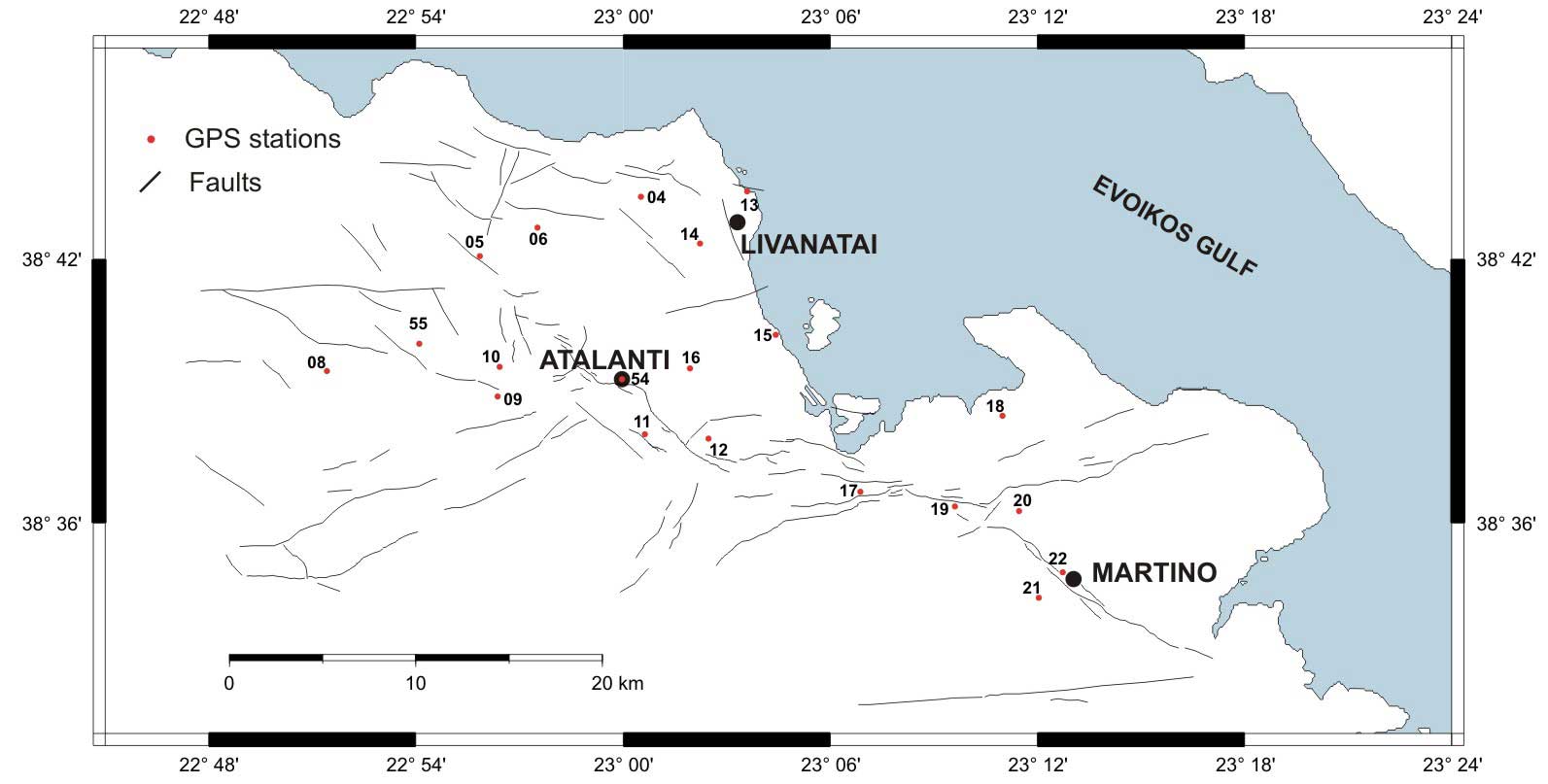
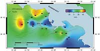
Research > GPS > Atalanti (1189x630 jpg, 55 Kb) The
Atalanti Fault System located in the central part of Greece, and is one
of the main tectonic active systems of central Greece. The last
reactivation of the system resulted in the major earthquakes of 1894
(M=6.7 and M=7) causing very serious damages to the region.
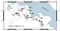
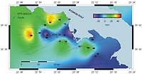
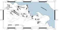
The GPS network has been remeasured during October 2002. Figure 1: The Atalanti Faulting Zone GPS network
The network was referred to Dionysos (Athens) permanent GPS station, run by Prof. D. Paradeisis - NTUA Higher Geodesy Laboratory, to measure the regional deformation of the Atalanti Faulting Zone. Dionysos GPS station moves to about SSE with a velocity of about 13 mm/year, and . upwards about 0.5 mm/year. The GPS station No 54 located to the city of Atalanti was used as a reference station with fixed co-ordinates to study the local ground deformation.
|
|
[GPS|DINSAR|Thermal Imaging|Optical
Images|GIS|Digital
Cartography]
[Personnel|Recent publications|Projects|Links] [webmaster@space-unit.gr] |